I decided to conduct a few tests with my fona808.
- Battery. The at+cbc command give you the current charge mode, percent charged, and millivolts. I found on the adafruit fona808 that the charge mode indicator always gave status 0 (“not charging”) even when charged.
- GSM Location. This is given by the at+cipgsmloc. It spits out lat and lon. I don’t know where it is getting the data from, but based on the plots I made the location it gives is an estimate based on your location to the nearest cell tower.
- GPS. Given by at+cgnsinf. I found this to be spot-on, always accurate, even with my pea-sized GPS antenna!
- DIY cell tower triangulation. If you put the fona into ENG mode (“AT+CENG=3”), it will give you the MNC, MCC, LAC, and CellId for the towers around you (i usually got six reports per “AT+CENG?” query). You can then use a site like cellphonetrackers.org to turn the tower info into a lat/lon coordinate. The +CENG messages also given a power level which you can use, in cojunction with the cell tower lat/lon coordinates, to perform the triangulation. The method of doing this is described elsewhere, but basically each power level becomes a weight, w_i = rx_i / (rx_0+rx_1…rx_n), which is multiplied by the lat/lon of the corresponding cell tower item. You then just add up the weighted lat/lons, and viola!
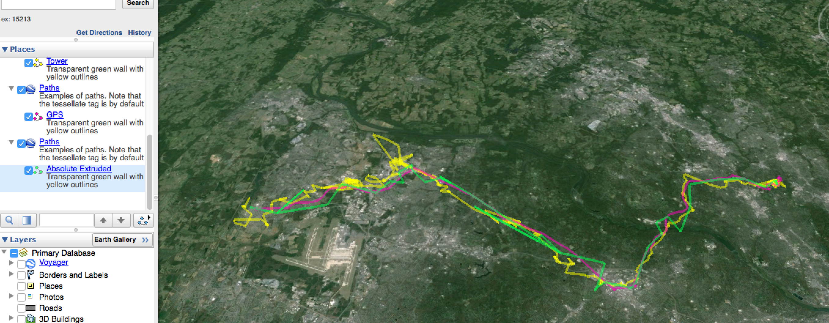
- I found that i lost about 10% power on my 1 hour trip. This seems terrible – barely 10 hours per charge, extrapolating.
- The GPS info was perfect. It took about 2 min to acquire
- The GSM location was too course, but was actually more clean than my DIY location
- DIY location seems crumby. Im not sure what would fix this. Possible things to look at: 1) Filtering. Maybe I could throw out the lowest power rating, or smooth out the locations somehow. 2) See if there are better cell tower dbs. As far as i know, cell tower info isnt public, so any db is most likely based on reported, possibly inaccurate, values
My results?
Here’s a map with plots of the three localization methods: GPS (magenta), GSM (green), and DIY Triangulation (yellow).